Record Cold in Late July: The Midwest Just Went From 323 Heat Records to Sub-40°F Mornings
Between July 22 and 24, at least 117 daily record lows fell across the northern US. Sac City, Iowa hit 39°F — eleven degrees below its 1985 record. Three weeks earlier the same states were shattering heat records. Counted from our live NOAA pipeline.
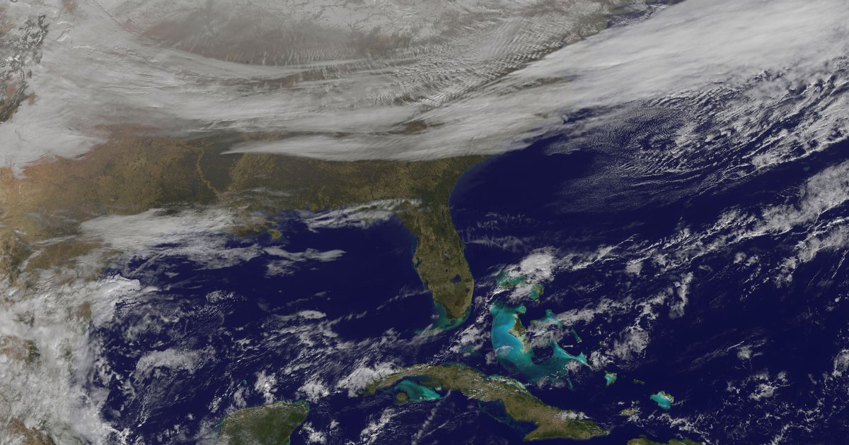
Between July 22 and 24, 2026, at least 117 daily record-low temperatures fell across the northern United States as a Canadian air mass dropped morning readings into the 40s — and, at a handful of rural and high-elevation sites, the 30s. Sac City, Iowa bottomed out at 39°F on July 23, a full eleven degrees below its previous July 23 record of 50°F set in 1985, in our NOAA records database.
Late July is normally the hottest week of the year for most of the country, which is what makes this odd. But the real story isn't the cold by itself — it's the whiplash. The exact same block of states that spent the first two weeks of July breaking heat records spun around and started breaking cold ones. A place like Fort Wayne, Indiana went from chasing 90°F afternoons to a 51°F morning in barely ten days.
Heat to Cold in Three Weeks — Same States, Same Data
Here's the number that reframes the whole event. Between July 1 and 14, the ten states that anchor this cold snap — Illinois, Ohio, Indiana, Iowa, Wisconsin, New York, Pennsylvania, Michigan, Minnesota and Kentucky — broke 323 daily high-temperature records during the month's two heat waves. Nine days later, the same region was setting record lows.
That kind of reversal is what a buckling jet stream looks like on the ground. When the ridge of high pressure that produced July's 116°F heat dome broke down, the pattern flipped: an upper-level trough dug into the eastern half of the country and let a dome of cool, dry Canadian high pressure slide south. Under clear skies and light winds, that dry air radiates its heat to space overnight — which is exactly why the anomaly showed up in morning lows, not afternoon highs.
Across the five days from July 20 to 24 our pipeline logged 238 daily heat records and 117 cold records nationwide — but the two barely overlapped in space. The heat hung on across the South and Southwest; the cold owned the north. New York and Illinois led the cold column with 14 broken records apiece.
| New York | 14 records |
| Illinois | 14 records |
| Iowa | 13 records |
| Ohio | 13 records |
| Wisconsin | 11 records |
| Indiana | 11 records |
| Pennsylvania | 10 records |
| Minnesota | 6 records |
Daily low-temperature records by state. Source: NOAA GHCN-D daily records, queried July 26, 2026.
Where It Actually Got Cold: The Airport Numbers
Rural cooperative stations always post the eye-popping numbers on cold nights — a sheltered valley can radiate ten degrees colder than the airport a few miles away. So the table below sticks to long-record first-order and airport stations, the ones with 40-plus years of history and the cleanest siting. These are the readings you can trust.
Two stand out. Ann Arbor, Michigan fell to 44.9°F on July 23, more than five degrees under its old July 23 record from 1981, and Altoona, Pennsylvania hit 46.9°F, three degrees below its 2000 record. Even Cincinnati — not a place you associate with 50-degree summer mornings — dropped to 53.9°F at Lunken Field.
| Station | Date | 2026 Low | Old Record |
|---|---|---|---|
| Park Rapids Muni Airport, MN | Jul 22 | 42.9°F | 44.0°F (1985) |
| Ann Arbor (U. of Michigan), MI | Jul 23 | 44.9°F | 50.0°F (1981) |
| Fargo Hector Intl Airport, ND | Jul 22 | 46.9°F | 48.0°F (1985) |
| Altoona Blair Co. Airport, PA | Jul 23 | 46.9°F | 50.0°F (2000) |
| South Bend Airport, IN | Jul 23 | 48.9°F | 50.0°F (2000) |
| Erie Intl Airport, PA | Jul 23 | 50.0°F | 51.9°F (1981) |
| Cedar Rapids Muni Airport, IA | Jul 23 | 51.0°F | 51.9°F (1970) |
| Findlay Airport, OH | Jul 23 | 51.0°F | 53.9°F (1981) |
| Fort Wayne Intl Airport, IN | Jul 23 | 51.0°F | 53.0°F (1990) |
| Cincinnati Lunken Field, OH | Jul 23 | 53.9°F | 55.9°F (2007) |
| Lexington Bluegrass Airport, KY | Jul 23 | 55.9°F | 57.0°F (2000) |
| Louisville Intl Airport, KY | Jul 23 | 60.9°F | 62.0°F (2007) |
Record daily lows at long-record airport/first-order stations, July 22–24, 2026. Source: NOAA GHCN-D daily records, queried July 26, 2026.
The Biggest Drops: Records Beaten by 7 to 11 Degrees
Breaking a daily record by a tenth of a degree is common. Breaking one by seven, or eleven, is not — it means the old mark wasn't just beaten, it was buried. Iowa took the worst of it. Sac City fell to 39°F, eleven degrees below its 1985 record, and across the border in Ohio, Springfield's water plant read 44°F, nearly eight degrees under a mark that had stood since 2000.
For perspective on how far these sit from the all-time extreme, the coldest temperature ever recorded in the Lower 48 — see our record of the coldest temperatures ever measured — is −70°F. A 39°F July morning is nowhere near that. What makes it a record is the calendar, not the thermometer: it's remarkable only because it happened in the last week of July.
| Station | Date | 2026 Low | Beat Old Record By |
|---|---|---|---|
| Sac City, IA | Jul 23 | 39.0°F | 11.0°F (was 1985) |
| Springfield WTP, OH | Jul 24 | 44.0°F | 7.9°F (was 2000) |
| Warren 3 S, OH | Jul 24 | 39.9°F | 7.0°F (was 2000) |
| Fairfield, OH | Jul 24 | 46.9°F | 6.1°F (was 2014) |
| Ann Arbor (U. of Michigan), MI | Jul 23 | 44.9°F | 5.1°F (was 1981) |
| Iowa City, IA | Jul 23 | 51.0°F | 4.9°F (was 2009) |
Largest margins below the previous record among stations with 40+ years of history. Source: NOAA GHCN-D daily records, queried July 26, 2026.
A Cold Blip in a Hot Year
A cold snap like this is real, and for a few mornings it genuinely reversed the summer. It also doesn't change the season's trajectory. 2026 is still on pace to finish among the hottest years measured — we track that in the running case for hottest year on record — and the interior heat that dominated early July is feeding the 2026 US drought. One cool airmass in late July doesn't undo either — and it didn't last. Within days the ridge rebuilt and the West went the other way entirely, breaking 449 heat records in the final days of July as Phoenix hit 116.9°F.
It's a good reminder of what "record" means, though. A record low doesn't make a place cold on average — the genuinely cool cities are a different list, which we ranked in the coldest cities in America. And it's the mirror image of the heat side of the ledger, where places like Minneapolis, Chicago, Detroit and Cleveland keep chasing the hottest temperatures ever recorded.
Want to see how your own town's July 23 compared to history? You can pull the record high and low for any US city on any date — including every day of this cold snap — with our weather-on-this-day lookup on the homepage.
Frequently Asked Questions
Why was it so cold in late July 2026?▾
A dome of Canadian high pressure slid south behind an upper-level trough between July 22 and 24, 2026, flushing unusually cool, dry air into the Midwest and Northeast. Clear skies and light winds under that airmass let overnight temperatures radiate away, and morning lows dropped into the 40s across the Great Lakes — into the 30s at some rural and high-elevation sites. It is the same jet-stream buckling that built the earlier July heat dome, only reversed.
How many record lows fell in late July 2026?▾
At least 117 daily record-low temperatures fell across the US between July 20 and 24, 2026, in our NOAA records data — the great majority on July 22–24 across the Midwest, Great Lakes and interior Northeast. New York and Illinois each broke 14, followed by Iowa (13), Ohio (13), Wisconsin (11) and Indiana (11).
What was the coldest temperature recorded during the July 2026 cold snap?▾
A high-elevation station at Vienna Mine, Idaho fell to 32°F — the freezing mark — on July 23. Among long-record airport stations, the standout was Sac City, Iowa at 39°F on July 23, a full 11°F below its previous record of 50°F from 1985. Fargo, North Dakota and Altoona, Pennsylvania both hit 46.9°F.
Is a record cold July unusual?▾
Very. Late July is climatologically the hottest stretch of the year for most of the country, so a cool shot that pushes mornings 20–30°F below normal is a genuine outlier. What makes 2026 stranger is the whiplash: the same ten-state region that broke 323 daily heat records between July 1 and 14 flipped to breaking record lows just over a week later.