Wildfire Season 2026: What 43 Years of Fire Data Show About El Niño Summers
Through June 9, the US has burned 2.5 million acres — 97% above the 10-year average at this point in the year. AccuWeather forecasts 5.5 to 8 million acres total for 2026. We cross-referenced 43 years of NIFC wildfire data with every El Niño event since 1983 and found something that should worry fire managers: the two worst fire seasons in modern US history — 2015 (10.1 million acres) and 2024 (8.9 million) — were both strong El Niño years. Another one is developing now. NOAA gives El Niño an 82% probability by summer.
By WeatherOnThisDay Research Team. Data: NIFC historical statistics (1983–2025), NOAA CPC ONI index, NOAA Drought Monitor, AccuWeather, CAL FIRE, Goss et al. (2025) JGR: Atmospheres. Sources cited inline.
2026 Is Already Running Nearly Double the Average
By June 9, NIFC had recorded 31,909 wildfires burning 2,512,945 acres. The 10-year average at this point in the season is 22,270 fires and 1.27 million acres. That puts 2026 at 42% above average in fire count and 97% above average in acreage — and peak fire season doesn’t start until July.
Eleven large incidents were actively burning as of the latest report, with 2,215 firefighters assigned. The national preparedness level sits at 2 (of 5), raised on March 20. The Southern Area has already reached geographic preparedness level 3 — meaning fire activity is drawing on national resources before summer even begins.
California tells the story clearly. Through early June, 2,087 fires have burned 60,773 acres, driven by a snowpack that came in at just 18% of average. The 18,379-acre Santa Rosa Island fire in Santa Barbara County burned for three weeks. The Sandy fire in Simi Valley forced evacuation of nearly 44,000 residents on May 18. Northern California lightning strikes in one week ignited over 2,000 fires. High-elevation timber fires above 7,000 feet are already burning in the Sierra — a pattern that normally doesn’t appear until late July.
Major California Fires (2026 YTD)
| Fire | County | Acres | Dates |
|---|---|---|---|
| Santa Rosa Island | Santa Barbara | 18,379 | May 15 – Jun 4 |
| Camp Roberts Bob | Monterey/SLO | 8,000 | May 14 – ongoing |
| Springs | Riverside | 4,176 | Apr 3–8 |
| River | Kern | 3,535 | May 18–22 |
| Border 6 | San Diego | 2,525 | Jun 1–6 |
| Sandy (Simi Valley) | Ventura | 2,183 | May 18–27 |
Source: CAL FIRE 2026 incident archive. New Mexico’s Seven Cabins fire (31,860 acres, Lincoln County) also significant — sparked by a medical plane crash on May 14.
Do El Niño Summers Actually Burn More? Here’s What 43 Years Show.
This is the question nobody has answered with actual data. We pulled every year of NIFC wildfire statistics (1983–2025) and cross-referenced each with the NOAA Oceanic Niño Index (ONI) to classify every year as El Niño, La Niña, or neutral.
The answer is more nuanced than a simple yes or no. Nationally, the top 10 worst fire seasons include years from all three ENSO phases. But look at the extreme end: the two worst fire seasons since 1983 with ONI above 2.0 (very strong El Niño) were 2015 (10.1 million acres, ONI 2.75) and 2024 (8.9 million acres, ONI 2.06). Those two years alone average 9.5 million acres — well above any decade’s average.
But 1997 (ONI 2.40, very strong) saw only 2.9 million acres. Why? Because the El Niño pattern isn’t a simple switch. It shifts fire risk regionally. Goss et al. (2025) in the Journal of Geophysical Research found that ENSO “influences wildfire in 91% of the country” with “strong, opposing effects” in different regions. NOAA/CIRES research confirms ENSO alters the likelihood of extensive area burned up to 12 months in advance.
Every Strong El Niño Year Since 1983 + Wildfire Acreage
| Year | ONI | Strength | Acres | Rank |
|---|---|---|---|---|
| 2015 | +2.8 | Very Strong | 10,125,149 | #1 all-time |
| 2024 | +2.1 | Very Strong | 8,924,884 | #7 |
| 1997 | +2.4 | Very Strong | 2,856,959 | Below avg |
| 1982 | +2.2 | Very Strong | 1,323,666 | Low (pre-modern) |
| 2009 | +1.6 | Strong | 5,921,786 | #11 |
| 2006 | +1.0 | Weak | 9,873,745 | #4 |
| 1991 | +1.7 | Strong | 2,953,578 | Below avg |
| 2004 | +0.7 | Weak | 8,097,880 | #12 |
| 1987 | +1.7 | Strong | 2,447,296 | Below avg |
| 2023 | +1.8 | Strong | 2,693,910 | Below avg |
Source: NIFC wildfire statistics (1983–2025), NOAA CPC ONI values. “Rank” is among all years, not just El Niño years. Highlighted rows are top-10 worst seasons overall.
How El Niño Shifts Fire Risk by Region
The counterintuitive part: El Niño can both increase and decrease fire risk, depending on where you are. The published research breaks it down into three distinct patterns:
Pacific Northwest
El Niño = warmer, drier winters. Reduced snowpack. Earlier snowmelt. Drier fuels by June. More fire risk. This is the region where El Niño most directly increases wildfire danger. 2015’s record fire year hit Washington hardest.
Southwest
El Niño = wetter winters. More grass growth. That vegetation becomes fuel the following dry season. Delayed but increased fire risk (lagged by 6–12 months). Tree-ring studies confirm this cycle stretching back centuries.
Southeast / Gulf Coast
El Niño = wetter conditions. Less immediate fire risk. But La Niña following El Niño creates drought, which is when the Southeast burns (2007, 2011, 2016 all followed El Niño).
For 2026, the regional picture is especially dangerous. NOAA CPC diagnosed ENSO-neutral with an El Niño Watch as of May 14, with Nino-3.4 at +0.4°C and subsurface temperatures increasing for six consecutive months. The 82% probability of El Niño developing by summer means the Pacific Northwest — already in the NIFC above-normal zone — faces the worst setup: an El Niño drying signal on top of existing drought and above-normal temperatures.
And the Southwest already had its most astonishing early heat wave in modern history. Phoenix hit 115°F in May — the earliest such reading in Arizona history. El Niño’s wetter winter sent California snowpack to just 18% of average, and the resulting grass growth in lower elevations is now curing into fuel.
The 10 Worst Wildfire Seasons in US History — and Their ENSO Phase
Here’s every season since 1983 that exceeded 8.5 million acres, with the ENSO phase at the time. AccuWeather’s upper forecast of 8 million acres for 2026 would land squarely in this list.
| # | Year | Fires | Acres | ENSO |
|---|---|---|---|---|
| 1 | 2015 | 68,151 | 10,125,149 | Strong El Niño |
| 2 | 2020 | 58,950 | 10,122,336 | La Niña |
| 3 | 2017 | 71,499 | 10,026,086 | Weak La Niña |
| 4 | 2006 | 96,385 | 9,873,745 | Weak El Niño |
| 5 | 2007 | 85,705 | 9,328,045 | La Niña onset |
| 6 | 2012 | 67,774 | 9,326,238 | Neutral |
| 7 | 2024 | 64,897 | 8,924,884 | Strong El Niño |
| 8 | 2018 | 58,083 | 8,767,492 | Weak La Niña |
| 9 | 2011 | 74,126 | 8,711,367 | La Niña |
| 10 | 2005 | 66,753 | 8,689,389 | Weak La Niña |
Source: NIFC wildfire statistics (1983–2025), NOAA CPC ONI values. El Niño years highlighted. The top 3 seasons are remarkably close: 10.13M, 10.12M, and 10.03M acres.
The Drought Map Tells You Where the Fires Will Be
As of June 2, 2026, the US Drought Monitor shows 48.78% of the lower 48 in drought, affecting 155.8 million people across 45 states. Overlay this with NIFC’s above-normal fire outlook and the worst-case regions become obvious.
Drought Severity and Fire Risk by Region
| Region | Drought | % in Drought | Fire Risk |
|---|---|---|---|
| New Mexico | D3–D4 | 85% | Extreme |
| North Carolina | D2–D3 | 88% | Very High |
| Northern Texas | D3–D4 | 75% | Extreme |
| Oklahoma | D3–D4 | 70% | Extreme |
| Pacific Northwest | D1–D2 | 45% | High |
| Northern Rockies | D1–D2 | 40% | High |
| California | D1–D2 | 55% | Very High |
| Southwest (AZ/UT) | D2–D3 | 60% | Very High |
Source: NOAA US Drought Monitor (June 2, 2026), NIFC June–September outlook. Fire risk assessment combines drought severity with NIFC above-normal outlooks.
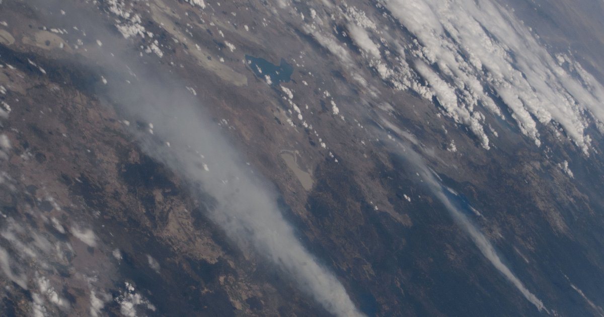
Wildfire Smoke: Who Gets Hit and When
The fires themselves burn in rural areas. But smoke travels. The Minnesota Pollution Control Agency warned of “an active alert season” in May 2026, projecting 12–16 days of wildfire smoke impacts for the Twin Cities and southeastern Minnesota. Seattle-Tacoma already ranks 8th worst in the US for daily particle pollution, with wildfire smoke driving the region “into unfamiliar territory” for air quality.
The combination of widespread drought, NIFC above-normal fire potential across the West, and a projected 5.5–8 million acres burning means smoke impacts will extend well beyond fire-adjacent areas. Based on recent patterns, the three regions expected to bear the worst smoke burdens are:
- Pacific Northwest (Seattle, Portland, Spokane) — already poor air quality; wildfire smoke peaks August–September
- California Central Valley (Bakersfield, Fresno, Visalia) — geographic bowl traps smoke; consistently ranks among worst US air quality
- Upper Midwest (Minneapolis, Rochester MN) — Canadian wildfire smoke drifts south; 12–16 impact days projected
Peak smoke season typically runs mid-July through September. If 2026 follows the trajectory of 2015 and 2024 (the two El Niño years that exceeded 8.9 million acres), expect smoke to be a headline weather story by August.
What to Watch This Summer
Three factors will determine whether 2026 ends up on the worst-ever list:
1. El Niño Strength
NOAA’s next ENSO diagnostic update is June 11. If El Niño officially develops and strengthens toward super El Niño territory (the ECMWF forecasts a potential +3°C), the Pacific Northwest faces a historically dangerous setup. CPC currently gives 96% probability of El Niño persisting through winter 2026–27.
2. Southwest Monsoon Timing
The monsoon normally brings relief to Arizona, New Mexico, and Colorado starting in mid-July. El Niño typically delays and weakens the monsoon. If the monsoon arrives late or weak — as it did in 2015 and 2023 — the Southwest’s extreme heat and drought will extend the fire window through August.
3. Lightning Events
Dry thunderstorms (lightning without significant rain) cause the largest fire complexes. Northern California’s 2020 August Complex Fire (1M+ acres) started from a dry lightning siege. Watch for dry thunderstorm events in July and August, especially across the Northern Rockies and Pacific Northwest.
If all three factors align — strong El Niño, delayed monsoon, dry lightning — AccuWeather’s upper forecast of 8 million acres is plausible. That would make 2026 the 8th worst fire season in the 43-year NIFC record and the third El Niño year in the top 10. If conditions break favorable (monsoon arrives on time, El Niño stays moderate), the 5.5-million-acre floor is still above the 10-year average of about 7 million.
Data Sources
Wildfire statistics from NIFC (1983–2025). ENSO phase history from NOAA CPC ONI values. El Niño–wildfire relationship from Goss et al. (2025), JGR: Atmospheres and NOAA/CIRES research. Drought data from US Drought Monitor. California fire data from CAL FIRE. Forecast from AccuWeather. Historical weather from our archive of 139M+ NOAA GHCN-D observations.
Related Analysis
Explore Fire-Prone State Records
Check Weather History for Fire-Prone Cities
Track Current US Wildfires
See active fire incidents, perimeters, and containment status updated daily.
View Active Wildfires →Look Up Historical Weather for Any US City
Search 139 million NOAA records covering 75+ years of daily temperature, precipitation, and snowfall data.
Search Weather History →